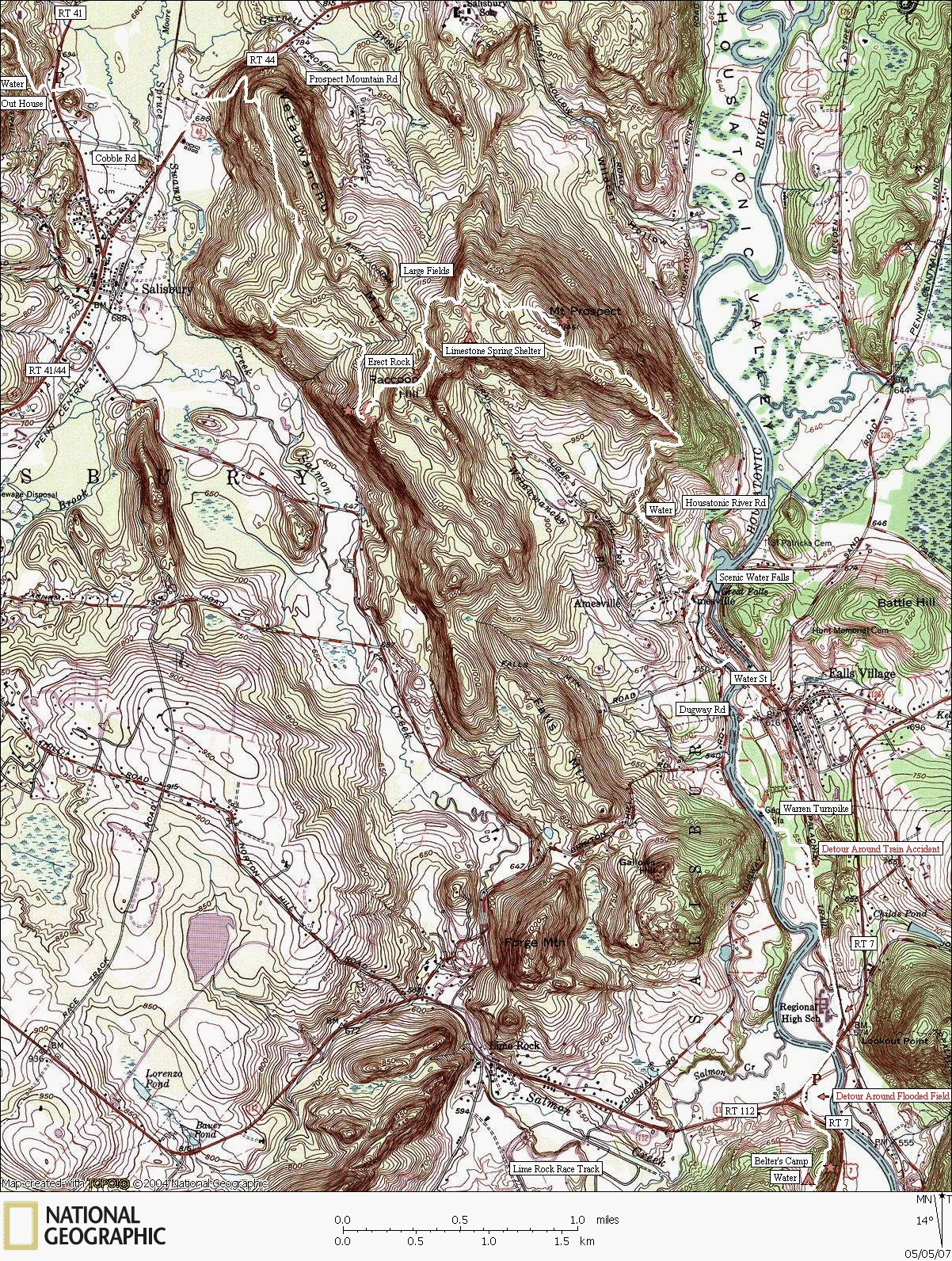
The Appalachian Trail
RT 41 to RT 112
Trail mapped by CTXGuide copyright 2007
Map created with TOPO! copyright 2007 National Geographic
Wetauwanchu Mountain has a steep approach, but once atop the ridgeline, it has a fairly level hike. The views may not be as scenic as from Bear Mountain, but there seems to be a mystical quality to the surrounding forest. The large erect rock, "Giants Thumb," is a peculiar outcropping that seems out of place and a bit spooky. The trudge to Mt Prospect is a good hike with a scenic view along it's eastern flank (A good place to eat lunch). There is a powerful water fall along the beautiful Housatonic River that marks the most scenic area of this stretch of trail.
As a side note, there is a detour around the train tracks that follows an unscenic road that passes the high school. We also took a detour to avoid a flooded field near the junction of RT 112 and Rt 7.


